PRECISION AGRICULTURE
Drones are revolutionising the agriculture industry by providing near real-time, high-resolution data that helps farmers make smarter, data-driven decisions. By using advanced imaging technologies like multispectral, thermal, and RGB cameras, drones can quickly assess crop health, soil conditions, and irrigation efficiency, without the need for time consuming manual inspections.
With aerial mapping and NDVI analysis, drones can detect early signs of crop stress, disease, or nutrient deficiencies, allowing farmers to act quickly and precisely, reducing waste and improving yields. They also assist in targeted spraying, ensuring pesticides and fertilisers are applied only where needed, reducing costs and environmental impact.
NDVI Analysis
Capture multispectral data to generate NDVI maps, to help farmers monitor crop health, detect stress early, and optimise resource use, leading to higher yields and reduced input costs
Irrigation Efficiency
Identify moisture variations across fields, highlighting overwatered or dry areas, allowing farmers to optimise irrigation, reduce water waste, and improve crop health and yield

Monitor Soil Conditions
Multispectral sensors analyse soil composition, moisture levels, and erosion risks, helping farmers make informed decisions on fertilisation, planting, and soil management
PADDOCK INSIGHTS YOU NEVER THOUGHT POSSIBLE
Make smarter, data-driven decisions by using advanced imaging technologies such as multispectral and RGB to assess crop health, soil conditions, and irrigation efficiency
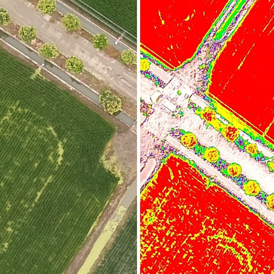
Crop Health. In Pictures
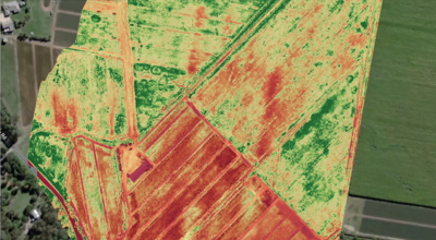
Normalized Difference Vegetation Index (NDVI) is a key tool in precision agriculture, providing insight into crop health and vegetation stress. Drones equipped with multispectral sensors capture data beyond what the human eye can see, identifying variations in plant health based on how they reflect near-infrared (NIR) light. NDVI maps allow farmers to detect early signs of disease, pest infestations, or nutrient deficiencies, helping them take targeted action before significant yield loss occurs.
The Benefits are clear:
•Early Detection: Identifies unhealthy crops before visible symptoms appear.
•Optimized Input Use: Apply fertilizers and pesticides only where needed, reducing costs.
•Improved Yield Prediction: Helps forecast harvest potential and adjust strategies accordingly.
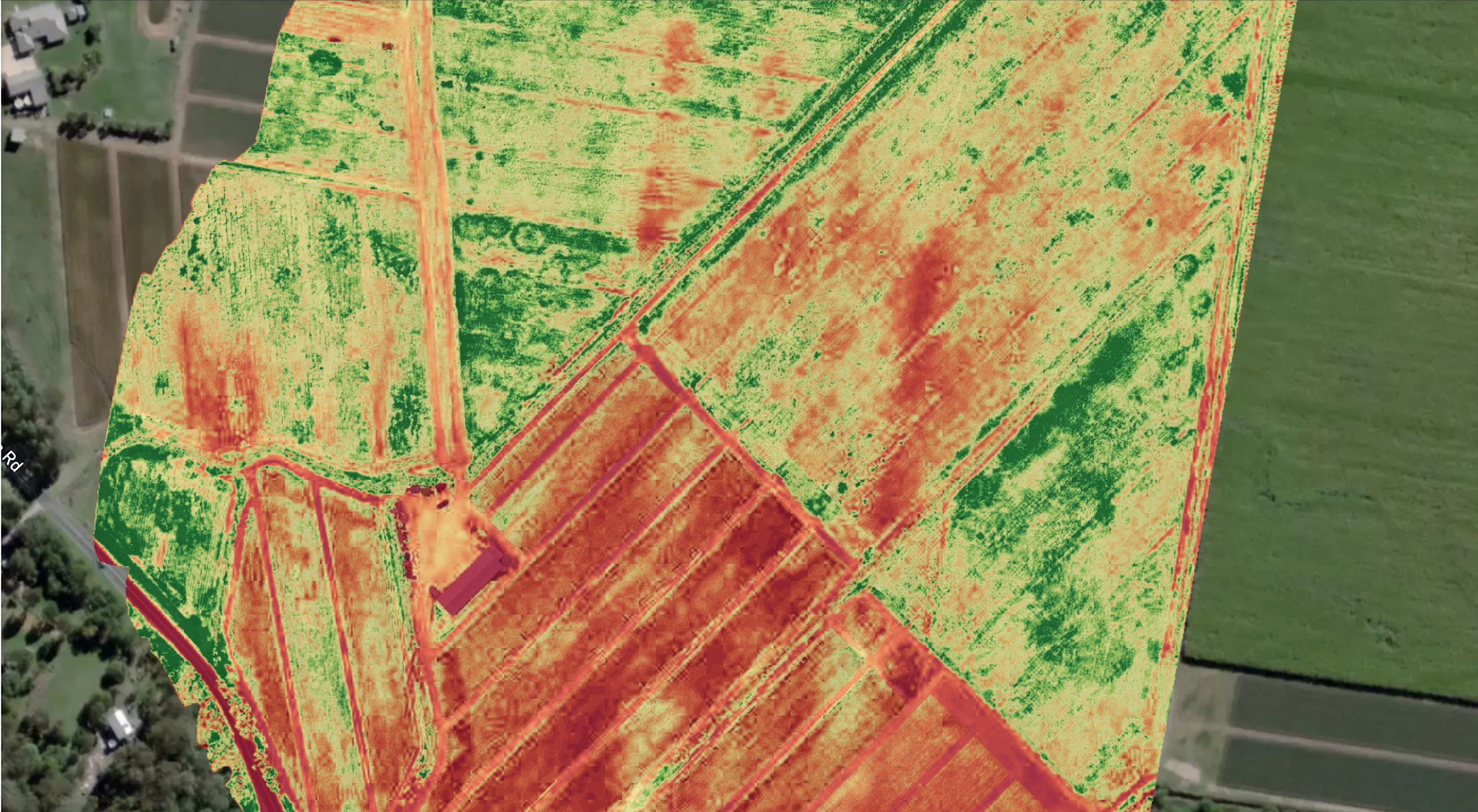
Your Soil is telling you something
Understanding soil health is fundamental for successful farming, and drones can rapidly scan large areas to identify variations in soil moisture, composition, and erosion risk. By using multispectral and hyperspectral imaging, drones detect organic matter levels, compaction zones, and nutrient distribution, providing data that helps farmers adjust planting strategies, fertilization plans, and soil treatments for maximum efficiency.
•Precision Farming: Tailor soil treatments to specific zones for improved crop performance.
•Erosion Control: Identify and address at-risk areas before they become a problem.
•Cost Savings: Reduce unnecessary fertilizer and water use by understanding soil variability.
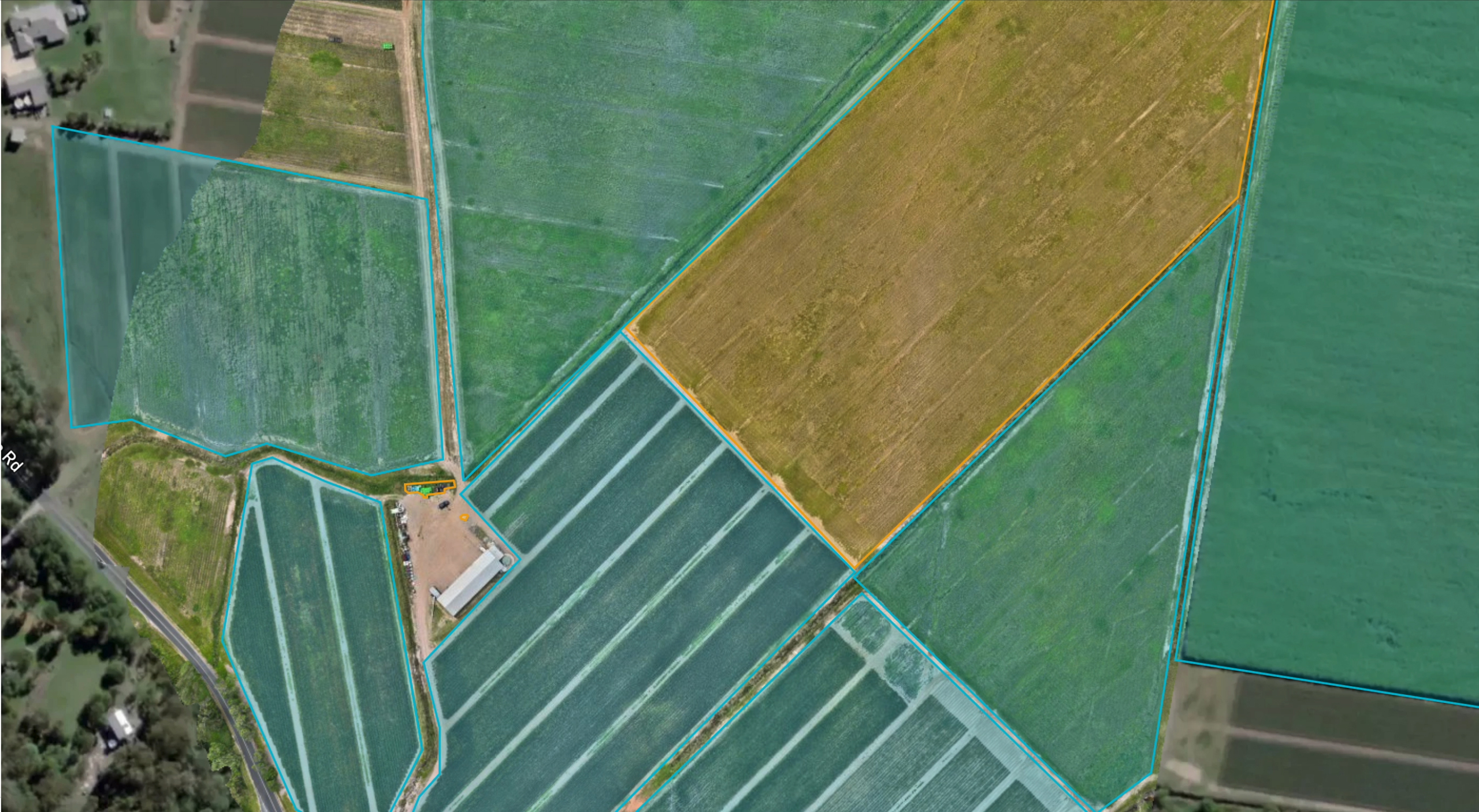
Visually Track Progress to make better decsisions
Farming operations require continuous monitoring, and drones provide aerial progression reports to track crop growth, land conditions, and infrastructure changes over time. By capturing high-resolution images and 3D models, farmers can compare field conditions across different growth stages, measure harvest readiness, and adjust their strategies based on real-time data rather than guesswork.
•Improved Decision-Making: See real-time changes and adjust farming techniques accordingly.
•Historical Data Tracking: Compare seasons and identify long-term trends.
•Operational Efficiency: Reduce manual field inspections and get comprehensive insights faster.
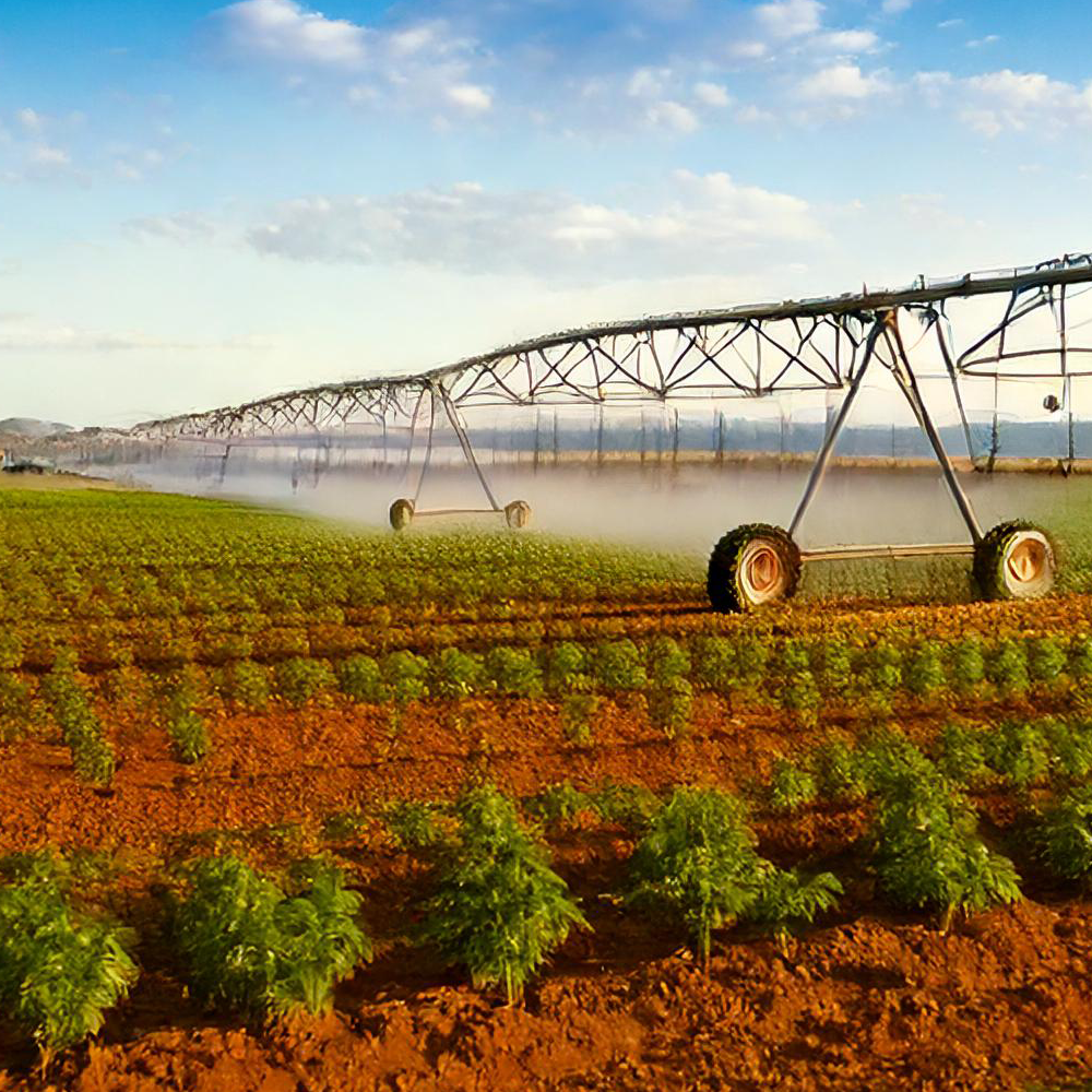
Wasting Water?
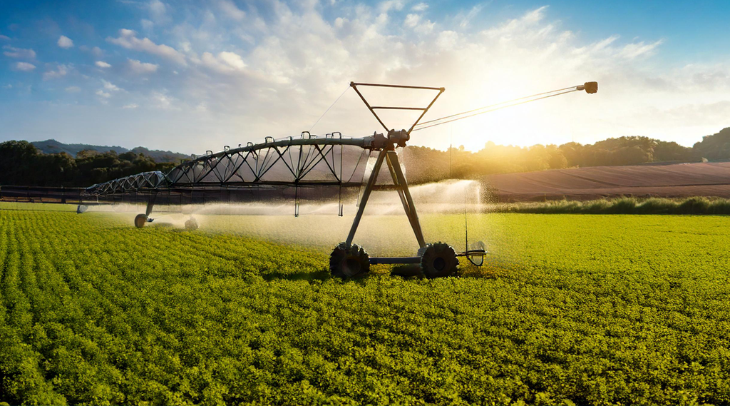
Water management is critical in farming, and drones provide real-time analysis of irrigation efficiency. Thermal imaging sensors on drones detect temperature variations in soil and crops, highlighting dry patches or overwatered areas that are invisible to the naked eye. This enables farmers to fine-tune their irrigation schedules and prevent both water wastage and crop stress caused by over- or under-watering.
Benefits:
•Reduced Water Waste: Optimize irrigation to conserve water and lower costs.
•Better Crop Health: Prevents root rot and dehydration by ensuring even water distribution.
•Sustainability: Supports eco-friendly farming with smarter water use.
Drones are transforming agriculture by providing fast, accurate, and actionable data, helping farmers maximize efficiency, reduce costs, and improve yields with less environmental impact.
Let’s design a solution that works for you!
QUESTIONS
CONTACT US
We’re a small but passionate group of experts located in South East Queensland but service the entire country.
We may be out flying right now, but please fill in your details below & we’ll get back to you as soon as possible!